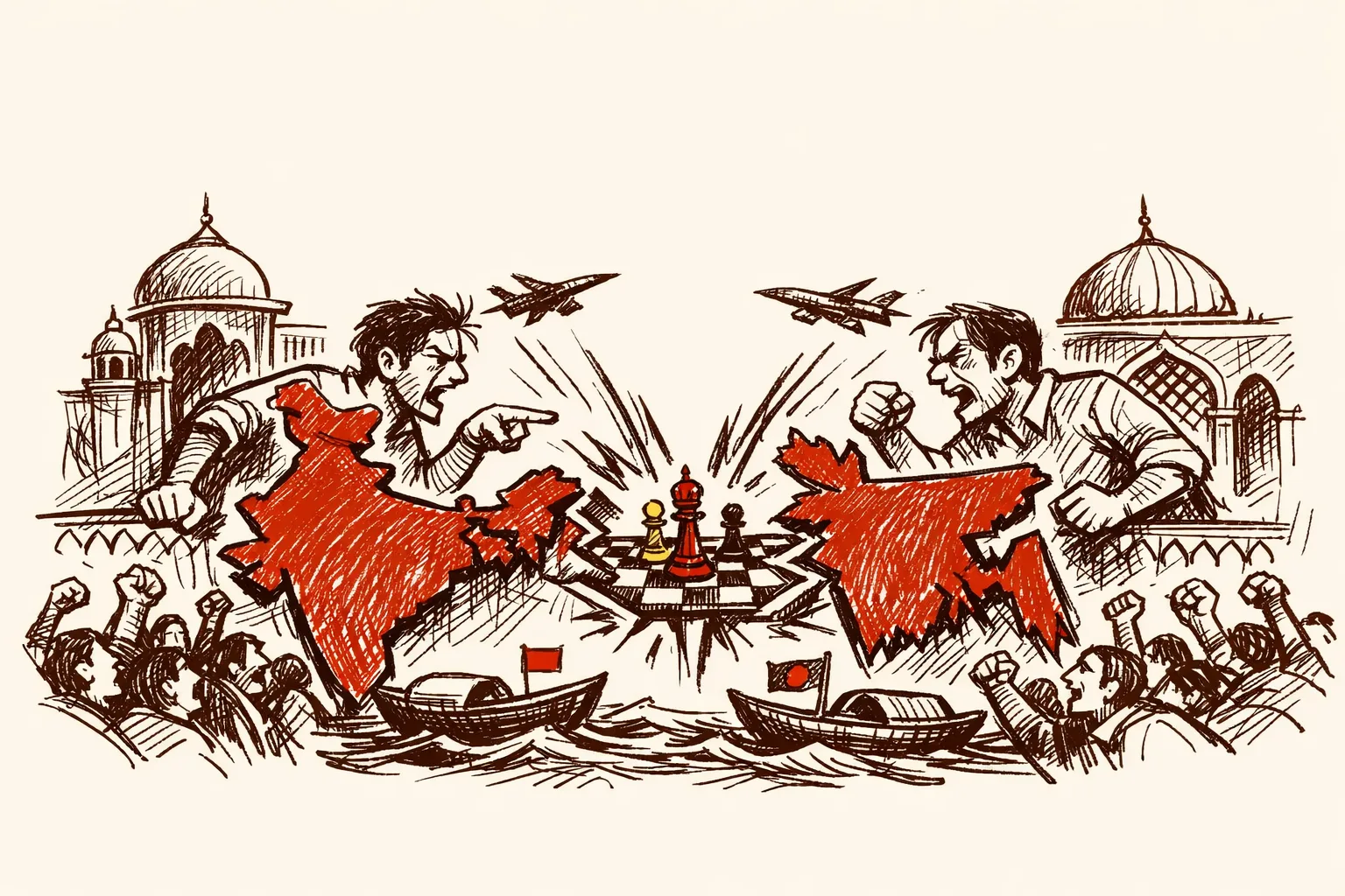
A Gift That Said Too Much
Picture this. The head of a neighboring government hands a top Pakistani military commander a book. On the cover is a map. That map shows India's seven northeastern states - Assam, Arunachal Pradesh, Manipur, Meghalaya, Mizoram, Nagaland, and Tripura - as Bangladeshi territory.
This is what happened when Bangladesh's interim chief adviser Muhammad Yunus met Pakistan's Joint Chiefs of Staff Committee chairman, General Sahir Shamshad Mirza, in Dhaka. Yunus presented a coffee-table book titled "Art of Triumph, Graffiti of Bangladesh's New Dawn" to the visiting general at the State Guest House Jamuna.
Bangladesh's government called the report false. Dhaka called India Today's coverage "completely false and fabricated" and said the book was a pictorial documentation of the mass uprising, released by the July Memorial Foundation. Yunus had earlier presented the same book to Justin Trudeau and Jane Goodall during his UN General Assembly visit.
So was this a genuine error? A graffiti-art cover that looked cartographically distorted? Possibly. But when you place this incident inside a clear pattern of similar provocations, the question of intent becomes very hard to avoid.
This Is the Fifth Time
The book gift is not an isolated event. It is the latest in a documented series.
In December, India's Ministry of External Affairs lodged a formal protest after a senior Yunus aide shared a "Greater Bangladesh" map on social media. India had "strongly registered a protest" and reminded Dhaka to be "mindful of public comments," according to MEA spokesperson Randhir Jaiswal.
Then came the China visit. During his maiden visit to Beijing, Yunus told Chinese officials that India's seven northeastern states were "a landlocked country" with "no way to reach the ocean," and that Bangladesh was "the only guardian of the ocean for this region" - something that "could serve as an extension of the Chinese economy." The pitch to China was explicit: treat India's northeast as a sphere of Bangladeshi - and Chinese - influence.
In April, at Dhaka University during the Bengali New Year celebrations, an Islamist group called Saltanat-e-Bangla, backed by a Turkish NGO called the Turkish Youth Federation, displayed a map of a so-called "Greater Bangladesh" that included Myanmar's Arakan State, Bihar, Jharkhand, Odisha, and the entire northeast region of India.
In May, after the Pahalgam terror attack that killed 26 civilians, Yunus's close aide Major General (retd) Fazlur Rahman suggested that Bangladesh should collaborate with China to occupy India's northeastern states if New Delhi attacked Pakistan. Yunus's government distanced itself from the remark. No reprimand was issued.
And now the Pakistan general's book gift.
General Mirza himself had just days earlier at the Islamabad Symposium called the Indian Army "politicised" and India's polity "militarised," and called for third-party mediation on Kashmir. Yunus chose this moment and this person to gift a book with that cover. That choice was not accidental.
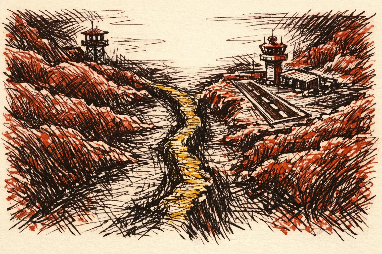
The Corridor That Makes This Dangerous
The controversy over the diplomatic insult is the smaller story. The deeper issue is geography.
The Siliguri Corridor is a 22-km-wide strip of territory in West Bengal that connects the northeastern states to the rest of India. If that strip is ever threatened, India's eight northeastern states are physically cut off from the mainland. That is why military planners call it the Chicken's Neck.
After the pro-India Awami League government was ousted in August and replaced by the Yunus administration, Indian security sources flagged the revival of the World War II-era Lalmonirhat airbase in northern Bangladesh - barely 135 km from the Siliguri Corridor - with reported active involvement of Chinese officials. The possibility of that airbase becoming a dual-use facility capable of hosting surveillance aircraft has triggered concern about Chinese military assets operating near India's eastern lifeline.
This is what makes the map controversy more than symbolic. The "Greater Bangladesh" narrative provides ideological cover for precisely the kind of encirclement that India's strategic planners fear most.
Who Is Driving the "Greater Bangladesh" Narrative
The idea of a Greater Bangladesh is not new. The Saltanat-e-Bangla group derives its name from the Bengal Sultanate, an independent Muslim-ruled kingdom that existed between 1352 and 1538 CE. The modern version is a territorial fantasy dressed up as historical correction.
What is new is who is funding it. External Affairs Minister Jaishankar informed Parliament that the Saltanat-e-Bangla group is backed by the Turkish Youth Federation. Multiple Turkish NGOs, including the Turkish Youth Federation and the IHH, are now active in Bangladesh, advancing pan-Islamist agendas. IHH has been repeatedly scrutinised internationally for its links with extremist networks.
The Pakistan-Turkey-Bangladesh triangle deserves attention. Turkey supported Pakistan during India's Operation Sindoor. Under Yunus, visa norms have been eased for Pakistani officials and the sea route has been opened to Islamabad. The pattern is coordination, not coincidence.
After the Yunus-Mirza meeting, Yunus's office stated that discussions focused on strengthening bilateral trade, investment, and defence ties. Defence ties. Between Bangladesh and Pakistan. The first high-level Pakistan military visit since the 1971 Liberation War - and that word "defence" sat quietly in the press release alongside the map-cover book.
What India Has Already Done
India has not been passive. The Modi government has responded with both economic and military moves.
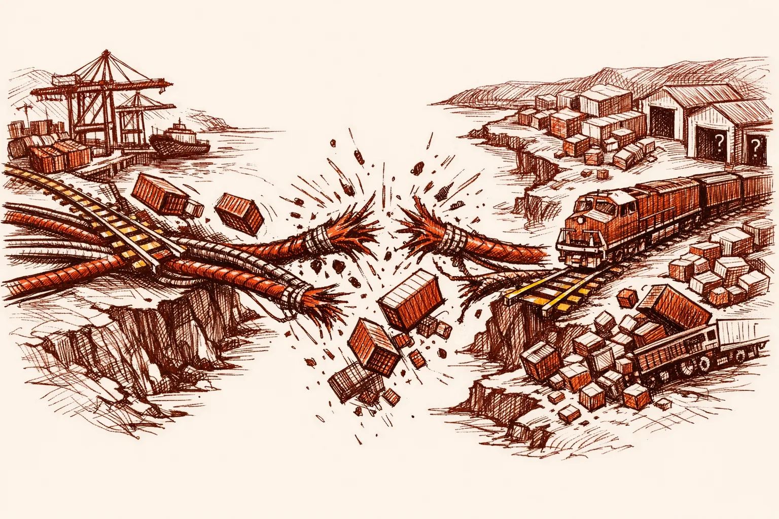
After Yunus's China remarks, India suspended the transit agreement that had allowed Bangladeshi goods to pass through Indian territory to Nepal, Bhutan, and Myanmar.
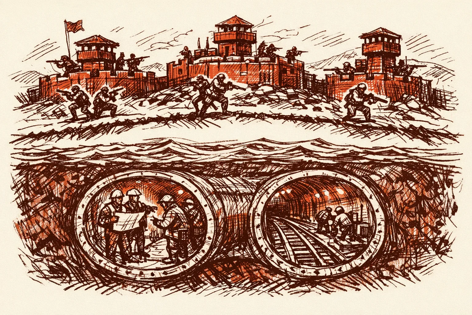
On the military side, India established three new military garrisons along its border with Bangladesh: the Lachit Borphukan Military Station near Dhubri in Assam, and forward bases at Kishanganj in Bihar and Chopra in West Bengal - specifically to strengthen the defence of the Siliguri Corridor. These sites are evolving into strategic hubs hosting rapid-response units, intelligence teams, and Para Special Forces elements. India is also exploring a fourth base near the India-Bangladesh border in Mizoram.
The government approved India's first underwater twin-tube road-and-rail tunnel project under the Brahmaputra river in Assam - a 15.79-km twin-tube tunnel connecting Gohpur on the north bank with Numaligarh on the south bank. India is also implementing plans for an underground railway line near Siliguri, reportedly buried at a depth of around 20 to 24 metres.
These are strong foundations. What is missing is a diplomatic doctrine that matches them.
How Other Countries Have Handled This
China's Response to Territorial Narratives
When foreign governments publish maps showing Chinese territory as belonging to another country, Beijing issues formal diplomatic protests within 24 hours, suspends specific bilateral agreements, and targets the specific ministry or publishing house responsible. China does not wait to see whether the map was "graffiti art" or a policy statement. It treats the map as the message and responds accordingly.
India should adopt the same logic. The question is not whether the book cover was intentional. The question is what it communicates - and what India's silence communicates back.
India's Own 1971 Playbook
In 1971, India closed its airspace to Pakistan - physically cutting off East Pakistan from West Pakistan's supply lines. That one move changed the strategic equation. India still holds the same geographic leverage today. Bangladesh's supply chains, transit access, energy grid, and medical tourism all run through or toward India. India has not used this leverage fully.
How the US Handles Ally Drift
When a US ally tilts toward an adversary, Washington suspends military aid, removes preferential trade status, imposes visa restrictions on officials, and publicly names those responsible. India has used some of these tools selectively. Cancelling the transit agreement was a smart first move. But India has not yet named specific Bangladeshi officials responsible for enabling the territorial narrative. Naming creates accountability. Silence is read as tolerance.
The Economic Stakes
Bilateral trade between India and Bangladesh totalled USD 13.51 billion in FY25. Bangladesh is India's biggest trading partner in the subcontinent and the largest recipient of Indian Lines of Credit at USD 7.2 billion. That relationship is now fraying. Disruptions to rail and road connectivity have affected supply chains, especially in India's northeastern states. Negotiations on deeper economic integration have stalled.
Every time a map controversy erupts, investor confidence in northeast India connectivity projects drops. Infrastructure built under Modi's Act East Policy loses momentum when the neighbor is signaling hostility.
The unease deepened with the inaugural China-Pakistan-Bangladesh trilateral summit in Kunming. Bangladesh's growing comfort with Beijing and Islamabad presents a direct challenge to India's connectivity projects.
Who Is Accountable
India's MEA formally protested the December social media map. It has not yet issued a formal statement on the Pakistan general book incident. That silence needs to end.
India's intelligence agencies have already flagged the Saltanat-e-Bangla network. A high-level multi-agency review was held in Siliguri under the Intelligence Bureau's Subsidiary Multi-Agency Centre, attended by the BSF, SSB, ITBP, state police, the Army, and the Railway Protection Force. That machinery needs to be connected to diplomatic action, not just internal assessment.
Eastern Army Commander Lieutenant General RC Tiwari personally inspected the new base at Chopra. The military preparation is serious. The diplomatic framework needs to match it.
What Would It Cost
The Brahmaputra twin-tube tunnel alone is a multi-billion-rupee project. Three new military garrisons have been stood up. A fourth in Mizoram is under consideration.
The cost of inaction is larger. Connectivity projects have been stalled and indefinitely suspended. Every suspended railway project, every cancelled transit agreement, every stalled trade corridor represents both economic loss and lost strategic depth for India's northeast.
Bangladesh is reportedly pursuing a USD 2.2 billion deal for Chinese J-10C fighter jets and considering Pakistan's JF-17 Block C aircraft. If that hardware comes in, Chinese maintenance teams and intelligence personnel would be positioned near the Siliguri Corridor permanently.
What Needs to Happen
India does not need to escalate. It needs to be precise.
First, the MEA must formally protest the book incident at the highest diplomatic level. India has already established the precedent. It must be consistent.
Second, India should name specific actors. The Saltanat-e-Bangla network, the Turkish Youth Federation's Bangladesh operations, and the officials who authorized the Lalmonirhat airbase renovations should all be named in diplomatic communications. A formal protest against a named individual costs Dhaka more than a general complaint.
Third, India's "Neighbourhood First" policy needs a hard reset clause: connectivity benefits are conditional on baseline respect for territorial integrity. That is not aggression. That is basic reciprocity.
Fourth, India should accelerate the Brahmaputra tunnel and the underground Siliguri rail corridor on a war footing. The infrastructure fix must move faster than the geopolitical threat.
Fifth, India should wait for Bangladesh's elections and calibrate accordingly. A democratic government in Dhaka will face different pressures than an unelected interim administration. India should be ready to reset quickly if elections produce a government that wants stable relations.
What India must not do is treat every provocation as an opportunity for social media outrage followed by diplomatic silence. That combination is read in Dhaka as a pattern India will not break. It must be broken.